
Geography of Nepal is uncommonly diverse. Nepal is of roughly trapezoidal shape, 800 kilometres (500 Miles) long and 200 kilometres (125 mi) wide, with an area of 147,181 Square Kilometers (56,827 sq miles). Nepal is commonly divided into four physiographic areas: the Mountain,Hills, Siwalik Region and Terai Regions. These ecological belts run east-west and are vertically intersected by Nepal's major, north to south flowing river systems. Nepal is roughly the same size as England or the US States of Michigan and Arkansas.
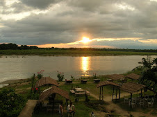
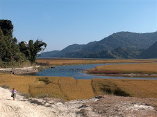
The southern lowland Plains bordering India are part of the northern rim of the Indo - Gangetic Plains. They were formed and are fed by three major rivers: the Kosi, the Narayani (India's Gandak River), and theKarnali. This region has a hot, humid climate.
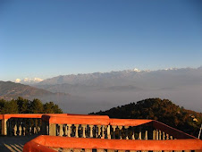
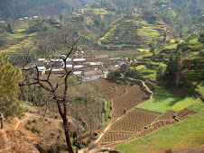
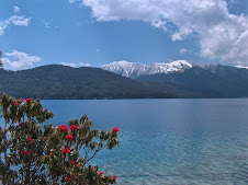
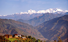
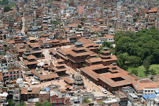
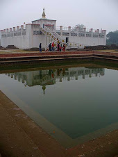
The Hill Region (Pahad) abuts the mountains and varies from 1,000 to 4,000 metres (3,300–13,125 Ft) in altitude. Two low mountain ranges, the Mahabharat Lekh andShiwalik Range (also called the Churia Range) dominate the region. The hilly belt includes the Kathmandu Valley, the country's most fertile and urbanised area. Unlike the valleys called Inner Tarai (Bhitri Tarai Uptyaka), elevations above 2,500 metres (8,200 ft) are sparsely populated.
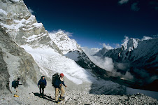
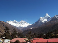
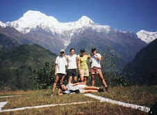
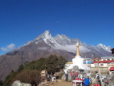
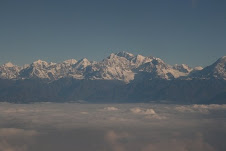
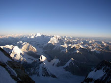
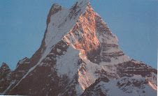
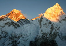
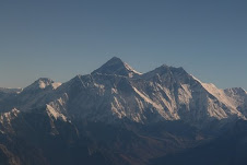
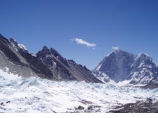
The Mountain Region, situated in the Great Himalayan Range, makes the northern part of Nepal. It contains the regions of highest altitude in the world; the world's highest mountain, 8,848 metres (29,028 ft) height Mount Everest (Sagarmatha in Nepali) is located here on the border with Tibet, the autonomous region of China. The Annapurna mountain range also lies in Nepal. In fact, seven more of the world's ten highest mountains are located in Nepal: Lhotse, Makalu, Cho Oyu, Kanchenjunga, Dhaulagiri, Annapurna and Manaslu.
Nepal has five climatic zones, broadly corresponding to the altitudes. The tropical and subtropical zones lie below 1,200 metres (3,940 ft), the temperate zone 1,200 to 2,400 metres (3,900–7,875 ft), the cold zone 2,400 to 3,600 metres (7,875–11,800 ft), the subarctic zone 3,600 to 4,400 metres (11,800–14,400 ft), and the Arctic zone above 4,400 metres (14,400 ft).
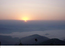
Nepal experiences five seasons: summer, monsoon, autumn, winter and spring. The Himalaya blocks cold winds from Central Asia in winter, and forms the northern limit of the monsoon wind patterns. Once thickly forested, deforestation is a major problem in all regions, with resulting erosion and degradation of ecosystems.
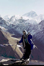
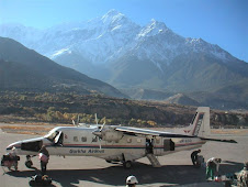
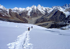
Nepal is a Mecca of mountaineering, containing some of the highest and most challenging mountains in the world, including Mount Everest. Technically, the south-east ridge on the Nepali side of the mountain is easier to climb; so, most climbers prefer to trek to Everest through Nepal.
Until the Sugauli Sandhi (treaty) was signed, the territory of Nepal also included Darjeeling, and Tista to the east, Nainital to the south-west and Kalapani, Susta, Garhwal to the west. However, as of today these areas remain annexed by India. As a result, Nepal shares no boundary with Bangladesh now and the two countries are separated by a narrow strip of land about 21 kilometre (13 mi) wide, called the Chicken's Neck. Efforts are underway to make this area a free-trade zone.The border dispute between India and Nepal have often been a cause of tension between the two countries. These days their is a call for a revolution in the ethnic Nepalese dominated area of Darjeeling for a different state to be known as Gorkha Land or in other words "Greator Nepal".


.jpg)
.jpg)


.jpg)
.jpg)

+-+Pokhara.jpg)
.jpg)
.jpg)
No comments:
Post a Comment